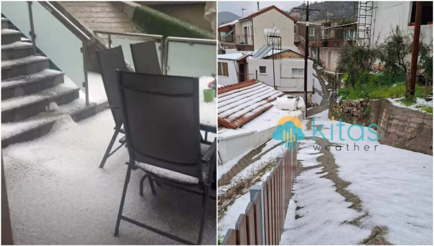
limassol hail — limassol hail — Heavy hail struck the Limassol district on Thursday at noon, leading to landslides in the Louvaras–Kaló Chorió area, according to police reports. The hailstorm was particularly intense in the Louvaras–Gerasas region, prompting cautionary measures for drivers.
The Department of Meteorology has issued a yellow warning for the area, indicating heavy storms, hail, and strong winds, effective from 11:00am to 6:00pm. Authorities are urging motorists to reduce their speed and maintain safe distances from other vehicles to prevent accidents.
Limassol hail: Current Weather Conditions
A low-pressure system is currently affecting the island, with another weather disturbance anticipated to arrive from the west tomorrow. This afternoon, conditions are expected to be partly cloudy with localised rain and isolated storms possible. Hail may accompany these storms, alongside shifting winds that are expected to strengthen.
The winds are forecasted to blow mainly from the north-west to north-east, with some areas experiencing south-easterly to south-westerly winds, ranging from light to moderate at 3–4 Beaufort. On windward coasts, winds could reach strong force 5, contributing to a slightly rough to rough sea.
Tonight’s Forecast
As night falls, local cloud cover will increase, leading to isolated rain or storms, especially in coastal and mountainous regions. Winds will remain predominantly westerly to north-westerly, sustaining light to moderate strengths of 3–4 Beaufort and potentially reaching strong force 5 in certain areas. Sea conditions will also worsen, becoming rough later on windward coasts.
Temperatures are expected to drop, with inland areas seeing lows of around 9°C, while the south and east coasts will be around 10°C. The west and north coasts will hover around 13°C, and the highest mountain peaks could see temperatures dip to 3°C, where frost is a possibility.
Looking Ahead to Friday and the Weekend
On Friday, cloud cover is likely to build, particularly in the west and north, bringing isolated rain or storms. By midday, widespread overcast conditions will set in, with localised rain and storms, particularly intense and prolonged on the west and south coasts. Hail is again a potential hazard during these storms, with snow or sleet expected on the highest peaks of Troodos.
Winds will predominantly be from the south-west, maintaining light to moderate strengths of 3–4 Beaufort, but could reach strong force 4–5 on windward coasts and temporarily very strong force 6 in some areas. The sea is predicted to become rough, with temperatures reaching 19°C inland and around 20°C on the south-east and east coasts. Remaining coastal areas will see temperatures around 17°C, with the highest mountains remaining cool at about 8°C.
This weekend, periodic local rain and isolated storms are expected to continue into Saturday, Sunday, and Monday. Hail is possible in storms, with snow or sleet again forecast for the highest peaks in Troodos. Saturday’s weather phenomena may be intense or prolonged, particularly affecting the west and south regions, with temperatures remaining below seasonal averages through Monday.