
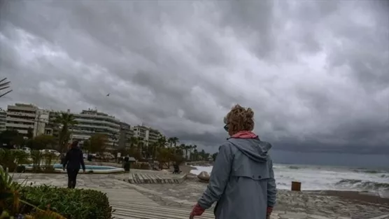
low pressure — Low pressure is affecting Cyprus, resulting in a cool Sunday night and a gradual rise in temperatures forecasted for the week ahead. As evening sets in, the weather remains predominantly clear, yet temperatures are expected to drop significantly.
Low pressure: Sunday Night Weather Conditions
This evening, winds are forecasted to be mainly from the north-west to north-east, ranging from moderate to locally strong, at 4 to 5 Beaufort. The sea conditions will reflect this, being slightly rough and occasionally rougher in certain areas. Inland temperatures are expected to fall to around 12 degrees Celsius, while coastal regions will see around 15 degrees. The mountainous areas will be the chilliest, with temperatures dipping as low as 7 degrees.
Monday’s Shift Towards Warmer Weather
As we transition into Monday, the weather is predicted to remain mostly clear, although there may be periods of increased cloud coverage. Winds will initially follow a north-westerly to north-easterly direction, maintaining a moderate strength of 4 Beaufort. However, a shift will occur later in the day, with winds changing to a light to moderate south-westerly to north-westerly direction at 3 to 4 Beaufort. The sea will remain slightly rough, but the day promises a significant temperature increase, reaching approximately 28 degrees inland and along the coast, while the mountainous areas will warm to around 17 degrees.
Evening Outlook for Monday
Monday night is expected to maintain the clear weather pattern, with winds calming to a light 3 Beaufort from the north-west to north-east. The sea will be calm, providing a pleasant evening for those outside.
Midweek Weather Patterns
The forecast from Tuesday through Thursday indicates a shift to partly cloudy conditions. There is a chance of isolated showers, particularly in the mountainous regions, primarily during midday hours. During this period, temperatures will continue to rise gradually, aligning closely with the average climatic values typical for this time of year.