
paphos-limassol highway — Heavy rain and dust are currently affecting visibility on the Paphos-Limassol highway, leading to hazardous driving conditions across Cyprus. A yellow weather warning has been issued, which is in effect until 6pm today.
Paphos-limassol highway: Current Weather Conditions
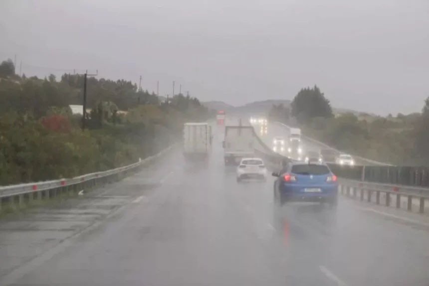
This Saturday afternoon, the combination of heavy rainfall and elevated dust concentrations has made sightlines particularly poor for drivers along the Paphos-Limassol motorway. Water accumulation is evident, with pooling at various points, resulting in slippery road surfaces.
Impact on Roads
Visibility is also markedly reduced on routes between Moniatis and Troodos, where dense fog and dust further complicate driving conditions. Local authorities are advising motorists to exercise caution, recommending reduced speeds, maintaining safe following distances, and keeping headlights illuminated.
Forecast for the Weekend
A low-pressure system is influencing weather patterns in the region. Dust particles are expected to linger in the atmosphere through Sunday, exacerbating the current conditions. The forecast for this afternoon indicates mainly cloudy skies, with localised rain and isolated thunderstorms anticipated. Winds during these storms may become variable and intensify, with the possibility of hail. Predominantly, winds will be south-westerly to north-westerly, categorised as weak to moderate, reaching force three to four, and occasionally up to force four to five. The seas are expected to be slightly rough to rough.
Outlook for Sunday
Moving into Sunday, isolated showers are predicted in the western and northern parts of Cyprus during the morning hours. As the day progresses, local rain and isolated thunderstorms are likely to shift towards the mountainous regions and eastern areas of the island. Hail may occur during these storms, with winds remaining south-westerly to north-westerly at a weak to moderate force of three to four. Coastal temperatures are expected to reach around 21 degrees Celsius, while higher mountainous areas may only see temperatures drop to about 13 degrees.
Weather Patterns Ahead
On Monday, there could be increased cloud cover around midday, potentially leading to isolated showers or a thunderstorm, particularly in the mountains south of Troodos. The weather for Tuesday and Wednesday is expected to be mainly clear, with some passing clouds in the afternoons. However, isolated light rain in the mountains remains a possibility on Tuesday.
Temperature Trends
Temperatures will likely rise slightly on Monday before stabilising at levels just below seasonal averages through Wednesday. Inland and coastal areas will see temperatures around 21 degrees, while the higher elevations will remain cooler.
Advice for Drivers
Given the current weather conditions, authorities are strongly advising all road users to remain vigilant. Drivers should approach affected areas with caution and adjust their driving behaviour to suit the prevailing conditions. It is crucial to stay informed about weather updates and heed warnings issued by local meteorological services.