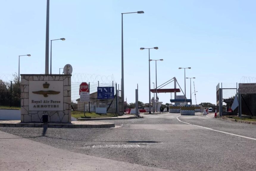
Hezbollah used Google Maps to target the RAF Akrotiri base in Cyprus during a drone strike earlier this month, according to a report by The Times. The attack specifically aimed at two American U2 spy aircraft that were visible on publicly available satellite images.
The UK newspaper detailed that the drone strike was believed to have been orchestrated from Lebanon, marking a significant escalation in Hezbollah’s operational capabilities. A military source described the incident as alarming, noting that the group successfully hit their intended target. However, the source cautioned that this was likely not a result of advanced intelligence gathering, suggesting instead that Hezbollah was utilising basic tools such as Google Maps and GPS.
Justin Crabbe, chief executive of intelligence firm Sibylline and a former British Army officer, commented on the implications of the attack. He indicated that the presence of U2 aircraft at the base was widely known, calling it “the worst kept secret in the Mediterranean.” Crabbe remarked that the accessibility of imagery on Google Maps made it unreasonably easy for Hezbollah to execute such a precise strike.
This method of leveraging publicly available imagery for targeting is not unprecedented. Crabbe recounted an experience from Iraq in 2004 when insurgents utilised Google Maps to target military camps based on identifiable features, such as the location of radio masts.
The drone involved in the attack was reportedly equipped with a Russian-made Kometa-B navigation system, a component that has previously been observed in devices captured by Ukrainian air defences back in December.
Sir Richard Knighton, head of the British armed forces, confirmed the involvement of an Iran-backed group in the drone strike, further asserting that this cooperation between Iran and Russia amplifies the threat posed by their forces. Knighton emphasised the necessity for vigilance in light of these developments.
The Times reached out to the UK Ministry of Defence regarding the satellite imagery that allowed Hezbollah to identify and strike the base. Questions were raised about whether measures would be taken to obscure sensitive areas of the base on Google Maps. As of Monday morning, however, the aircraft remained visible in the imagery, and the Ministry of Defence declined to comment on any potential actions to remove or blur these images.
Google has the capability to blur or mask sensitive locations upon request from governments, and some military installations in the region, including certain Israeli and US air bases, appear on the platform with reduced resolution or fully obscured aircraft.